
Saturday, October 5, 2013
Muni Ride 10/4/13
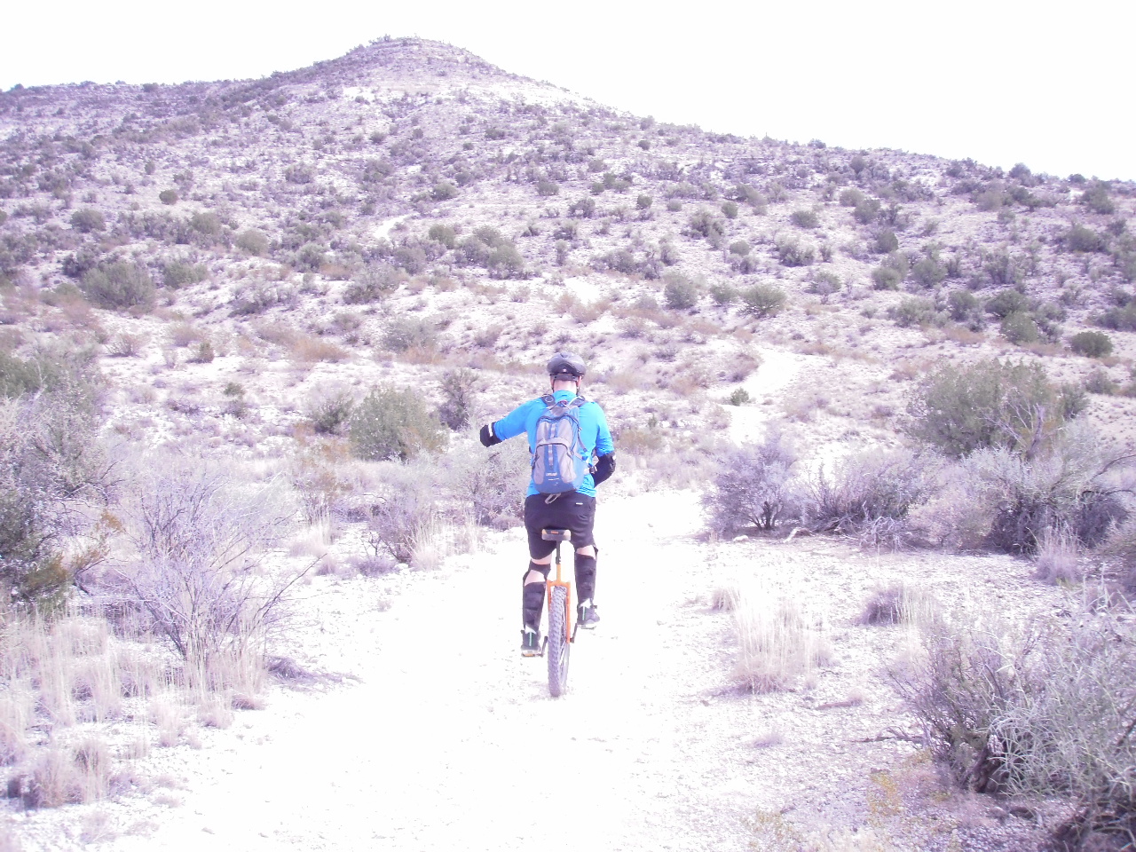
Had a nice Muni ride off Tissaw Rd. This ride has great views. This was a nice out and back ride. Ran into some young ladies on horses. I always worry about what animals will do when I ride by. It tends to freak them out. Here is a link to the ride.


Sunday, January 6, 2013
Muni Ride Camp Verde, Castle View Trail
 Castle View Trail (FYI, I made this name up this is not an official trailhead/trail)
3.66 miles out and back
Level of difficulty:
Blue Square
Clink "Link" to view the ride through, mapmyride.com
or copy and past this address: http://www.mapmyride.com/routes/view/163782760
I rode this trail going out and back starting at a dirt road leading off N. Montezuma Castle Hwy. in Camp Verde. I have a Prius so I parked along the roadway and started the ride from there. The dirt road is just too rough for a low profile vehicle. From where I parked you will need to cross a cattle guard and follow a jeep road down toward Beaver Creek. From Montezuma Castle Hwy. you can see the jeep road wandering down through the mesquite bosque. I stayed to the left as the jeep road headed toward the creek. The road will drop right down to the water. I was lucky this time of year and was able to rock hop across the creek. In the early spring you will NOT be able to cross this creek. Even the locals that live across and just downstream use a walking bridge to get across the creek to their homes during the snow-melt. Once across the creek the jeep road narrows down to an ATV width and is used by a lot of the local horseback riders. After leaving the creek, the trail makes a short climb and then crosses a flat for about 1/2 mile. This section of the trail gives you a good view of Montezuma Castle and the surrounding cliffs. After this flat the trail takes a sharp climb and continues for about a mile. Occasionally, I could get on the Muni and ride a short distance but I was walking a lot during this section. The good news is that I could ride almost all of it on the way back!!! I turned around just short of 2 miles. At this spot the trail started to flatten out. You could keep going and easily make this a 10+ mile ride. The trails and road interconnect on top of the mesa and just go on and on for miles. The trail surface varies from packed sand, to river rock, to limestone.
Directions To Trailhead:
Head north on I17 and get off at the third and last Camp Verde freeway exit. Exit I17 onto Montezuma Castle Hwy. and head south (Take a right). You will need to work your way through a couple of round-abouts, but you will need to stay heading south on Montezuma Castle Hwy. for about 1.2 miles. The jeep road starts on the left just after you pass N. Arena Del Loma. If you pass a school on your right.... you went too far.


Trail difficulty Key:
Green Circle: Beginner Muni rider trail. Trail very smooth with minimal drops and ridable climbs.
Blue Square: Intermediate Muni trail. Challenging descents, difficult climbs, some walking required.
Black Diamonds: Advanced to Expert Muni level trail. Extreme descents, most all will walk climbs.
Muni Ride Sedona, Long Canyon and Deadman's Pass

Long Canyon and Deadman's Pass Trails.
4.75 miles out and back
Level of difficulty:
Green Dot
Clink "Link" to view the ride through, mapmyride.com
or copy and past this address: http://www.mapmyride.com/routes/view/163504456
I rode this trail going out and back starting at the Long Canyon Trailhead. This is a great spot to start the ride because there is no fee to park at this trailhead and it starts to climb from the car. This is a nice, ridable climb from the start for about 1.25 miles. Just short of a mile you will come to a "Y" in the trail and you will need to take the left fork to place you on the Deadman's Pass Trail. If you stay to the right you will continue up Long Canyon Trail BUT it leads you into the wilderness area and bikes are not allowed; just foot and horse traffic. Make the left and avoid a possible ticket. Now if you are thinking it through, you've just realized that you have about a 1.25 mile descent back to the car. Halfway to the Deadman's Pass parking area you will ride through the trail summit. The second half of this ride out has a few technical descents. These are a lot of fun and are quite the reward for completing the climb to the summit. Most of the trail is packed red sand, and it is a great surface to ride on. You will come to the Deadman's Pass Trailhead after riding about 2.4 miles. There is a bathroom at this location if nature is calling. If the trail is calling, turn around and head back. This trail is wicked fun in both directions.
Directions To Trailhead:
Head north on 89A from Cottonwood toward Sedona. You will turn left on Dry Creek Road at about about mile post 371. After turning left on Dry Creek Road go 2.9 miles and you will come to a stop sign. Turn right onto Long Canyon Road and go 0.6 miles. The trail Head will be on the left. There is some parking on both the left and right side of the road. (Just before you get to the trail head you will see lots of parked cars at the Mescal Trailhead. Long Canyon Trailhead is just past this spot.)

Trail difficulty Key:
Green Circle: Beginner Muni rider trail. Trail very smooth with minimal drops and ridable climbs.
Blue Square: Intermediate Muni trail. Challenging descents, difficult climbs, some walking required.
Black Diamonds: Advanced to Expert Muni level trail. Extreme descents, most all will walk climbs.
Wednesday, January 2, 2013
Muni Ride Sedona, Old Post Trail

3 miles one way
Level of difficulty:
First 1.5 miles Black Diamond
Second 1.5 miles Blue Square
Clink "Link" to view the ride through, mapmyride.com
or copy and past this address: http://www.mapmyride.com/routes/view/162790548
I rode this trail going one direction, from south to north. The first 1/2 of the trail going north was, what I would consider, a black diamond trail. The first 1/2 of this ride had a lot of loose large rock with jagged rock outcroppings cutting across the trail. Almost all of the 440 ft. elevation gain came in the first 1.5 miles of the ride/hike. I was forced to walk large sections of this trail during the first 1.5 miles. I was planning on just riding one way so I could meet my family at the north end of this trail. The north end of the trail dumps you right in the middle of upper Sedona. It would be real easy to ride you unicycle up Shelby Drive and have some coffee or lunch before turning around and heading back.
The second 1/2 of this ride was wonderful. I would classify this section as a blue square. Lots of challenging descents on a wonderful single track trail. I look forward to riding this trail again in the opposite. I did this ride on January 2nd. with a 10:30 start time. This made for a cooler ride with some snow patches in the shady areas.


Directions To Trailhead:
Take 89A north from Cottonwood toward Sedona. Turn right onto Upper Red Rock Loop Road. (First traffic light you come to, you will see the Sedona High School on you right.) After about a mile you will make a left onto Chavez Ranch Road. The trailhead will be on your left. Parking on the side of the road.
Trail Difficulty Key:
Green Circle: Beginner Muni rider trail. Trail very smooth with minimal drops and ride-able climbs.
Blue Square: Intermediate Muni trail. Challenging descents, difficult climbs, some walking required.
Black Diamonds: Advanced to Expert Muni level trail. Extreme descents, most all will walk climbs.
Saturday, October 20, 2012
Uni Ride with Kylie 10/9/12
We had a great ride in San Luis Obispo. Here is the link for Map My Ride.
Here is a photo of Kylie riding on a trail and on the beach.


Here is a photo of Kylie riding on a trail and on the beach.


Muni Progress
Muni ride 10/20/12
Had a great ride today. Went over to Tissaw Rd. again. I am doing better on the climbs. Here is the link.
Monday, September 3, 2012
Miuni
I have been riding my Muni a lot lately. I have been riding it every chance I get on the weekend. I need to pick up the distance. I am getting about 5 miles every time I head out. I need to start pushing that to 6 and 7 miles. I am going to start posting my Muni ride through map my ride.com on the blog. First I need to figure out how to do it. :) I decided to add a link to the web address for today Muni ride. Click the link below.
link
Monday, June 25, 2012


Saturday, June 23, 2012

Tuesday, December 20, 2011
Books
I was diagnosed with Colon Cancer on July 16th 2008. I had a successful colon resection and at that point have been determined to be cancer free. I have decided to list some of the good books that I have read since my cancer diagnosis.
Books I recommend for reading are:
For Heath:
The China Study; By T. Colin Campbell PhD. (5 Stars)
The McDougall Plan; By john A. McDougall, M.D. (5 Stars)
The Mad Cowboy; By Howard F. Lyman (4 Stars)
Diet for a New America; By John Robbins (5 Stars)
The Ethics of What We Eat; By Peter Singer (4 Stars)
Prevent and Reverse Heart Disease; By Caldwell B. Esselstyn, Jr., M.D. (5 Stars)
Dr. Attwood's Low Fat Prescription for Kids, By Charles R. Attwood, M.D. (5+Stars)
A Vegetarian Doctor Speaks Out, By Charles R. Attwood, M.D. (3 Stars) (sm.version/pre. book)
For Inspiration:
Its Not About the Bike
Every Second Counts
Currently Reading:
Ending the Food Fight; By David Ludwig, M.D., Ph.D.
Letters to a young activist; By Todd Gitlin
Please feel free to suggest other good books for reading.
Books I recommend for reading are:
For Heath:
The China Study; By T. Colin Campbell PhD. (5 Stars)
The McDougall Plan; By john A. McDougall, M.D. (5 Stars)
The Mad Cowboy; By Howard F. Lyman (4 Stars)
Diet for a New America; By John Robbins (5 Stars)
The Ethics of What We Eat; By Peter Singer (4 Stars)
Prevent and Reverse Heart Disease; By Caldwell B. Esselstyn, Jr., M.D. (5 Stars)
Dr. Attwood's Low Fat Prescription for Kids, By Charles R. Attwood, M.D. (5+Stars)
A Vegetarian Doctor Speaks Out, By Charles R. Attwood, M.D. (3 Stars) (sm.version/pre. book)
For Inspiration:
Its Not About the Bike
Every Second Counts
Currently Reading:
Ending the Food Fight; By David Ludwig, M.D., Ph.D.
Letters to a young activist; By Todd Gitlin
Please feel free to suggest other good books for reading.
Saturday, April 30, 2011
Meeting with Supervisor Chip Davis
I was invited to a meeting with Supervisor Chip Davis on April 28th. In this meeting Supervisor Davis and members from the public works department announced that they had some solution to make the Cornville Rd. project safer for cyclists. This was a great moment for me. I felt like I had made a difference in something that is very important to cyclists. I feel empowered, and want to continue to move forward as a cycling activist. This was a good day for the Verde Valley and the cyclist that come to this area.
Supervisor Davis and the public works department came up with a way to give cyclist a 4 foot shoulder on the up hill side of the road through the Cornville switchbacks. This is a life saving change to the Cornville Rd. improvement project plans.
Supervisor Davis and the public works department came up with a way to give cyclist a 4 foot shoulder on the up hill side of the road through the Cornville switchbacks. This is a life saving change to the Cornville Rd. improvement project plans.
Articals & Letters to the local paper
Saturday, March 26, 2011
Cornville Rd. Letter Reply to Chris Moran March 21st, 2011
Dear Mr. Moran,
Thank you for your response to my letter concerning the Cornville road widening project. I cannot adequately express my fear and concern from the information that you sent me. "In the switchbacks area, there will be a 2’ wide paved shoulder on the south side only – there will be no paved shoulder provided on the north side." I do not understand this logic. If you only have room for a 2' shoulder, why on earth would you put this shoulder on the south side of the road? As a cyclist I do not need a shoulder on the south side. This would be a descent and I can travel at the same rate of speed as the motorized traffic. Very few, if any, cars will need or attempt to pass me on my bike on the south (east bound) side of the roadway. It is the north (west bound) side of the roadway that MUST have a shoulder. As a cyclist, I can only travel at speeds from 5-10 mph on the west bound side of the roadway. Depending on the traffic and speed of my ascent, I may be passed by 18-40 vehicles. On one occasion I counted no less than 22 vehicles (one was a commercial tractor trailer, and another was a dually truck pulling a fifth wheel horse trailer) that passed me while ascending this short section of Cornville Rd., and this was not a heavy traffic day. To add to my fears, my route up the north side of the roadway is currently hindered by guard rails to keep traffic from going down into a steep canyon, while at the same time giving me NO way to avoid colliding with those vehicles who are not providing me with enough room to travel.
Your suggestion of the use of the park and ride facility and/or existing "trails" is impractical for someone using a road bike. A road bicycle is not designed for trail riding, and using the park and ride defeats the purpose of using a bike at all as a means of transportation. While those solutions may work for others, they do not address my specific concerns.
Please... I am asking for a meeting with you and/or Supervisor Davis to talk about this. It is imperative that the Cornville road widening project provide a shoulder on the north side of the roadway through the switchbacks!
Please contact me as soon as possible to discuss this matter in person. Perhaps a meeting could be arranged with representatives of the local cycling community via the Verde Valley Cyclists Coalition. I look forward to your reply.
Thank you for your response to my letter concerning the Cornville road widening project. I cannot adequately express my fear and concern from the information that you sent me. "In the switchbacks area, there will be a 2’ wide paved shoulder on the south side only – there will be no paved shoulder provided on the north side." I do not understand this logic. If you only have room for a 2' shoulder, why on earth would you put this shoulder on the south side of the road? As a cyclist I do not need a shoulder on the south side. This would be a descent and I can travel at the same rate of speed as the motorized traffic. Very few, if any, cars will need or attempt to pass me on my bike on the south (east bound) side of the roadway. It is the north (west bound) side of the roadway that MUST have a shoulder. As a cyclist, I can only travel at speeds from 5-10 mph on the west bound side of the roadway. Depending on the traffic and speed of my ascent, I may be passed by 18-40 vehicles. On one occasion I counted no less than 22 vehicles (one was a commercial tractor trailer, and another was a dually truck pulling a fifth wheel horse trailer) that passed me while ascending this short section of Cornville Rd., and this was not a heavy traffic day. To add to my fears, my route up the north side of the roadway is currently hindered by guard rails to keep traffic from going down into a steep canyon, while at the same time giving me NO way to avoid colliding with those vehicles who are not providing me with enough room to travel.
Your suggestion of the use of the park and ride facility and/or existing "trails" is impractical for someone using a road bike. A road bicycle is not designed for trail riding, and using the park and ride defeats the purpose of using a bike at all as a means of transportation. While those solutions may work for others, they do not address my specific concerns.
Please... I am asking for a meeting with you and/or Supervisor Davis to talk about this. It is imperative that the Cornville road widening project provide a shoulder on the north side of the roadway through the switchbacks!
Please contact me as soon as possible to discuss this matter in person. Perhaps a meeting could be arranged with representatives of the local cycling community via the Verde Valley Cyclists Coalition. I look forward to your reply.
Kevin Dix
Teacher/Cyclist
(928) 202-1338
Cornville Rd. Letter Responce from Chris Moran 3/21/11
Dear Mr. Dix,
The Cornville Road Widening Project will have 4’ wide paved shoulders on both sides for the first 1.58 miles of the project – approximately east of Tissaw Road to the top of the switchbacks area. In the switchbacks area, there will be a 2’ wide paved shoulder on the south side only – there will be no paved shoulder provided on the north side. In the main town Cornville area, there will be 5’ wide paved shoulders on both sides up to Windmill Park. East of the Oak Creek Bridge, 4’ wide pave shoulders will be provided up to the end of project (east of Aspaas Road).
Note – the Cornville Multi-Use Path will be installed between the intersection of SR 89A and Cornville Road to east of Verde Santa Fe subdivision. There will be a park-and-ride facility constructed in the Forest Service land east of Verde Santa Fe subdivision. This park-and-ride facility will connect to the existing trails in the area – these existing trails will provide safe access for bicyclists to enter the Cornville area so they can avoid using the switchbacks area.
Hope this information is useful.
Chris Moran on behalf of Supervisor A.G. “Chip” Davis
Board of Supervisors, District 3
928-639-8110
Chris.moran@co.yavapai.az.us
Cornville Rd. Letter to Chip Davis 3/16/11
Supervisor Chip Davis,
My name is Kevin Dix. I am a teacher for the Cottonwood-Oak Creek School District and an avid cyclist who rides throughout the Verde Valley. The latter is the reason I am writing you today. It has been brought to my attention that a road improvement project has been scheduled to improve a section of Cornville Road from Tissaw Road, past Windmill Park to Aspaas Road. It has also been brought to my attention that this road improvement project will not include a bicycle lane. I cannot express the disappointment I experienced when I heard this news.
Cornville Road is the only road that connects Cottonwood to Rimrock and the Village of Oak Creek without using the freeway. Cornville Road is a very busy road with vehicles traveling at high speeds, many surpassing the speed limit. I personally have had many drivers come too close to me (much closer than the 3-5 feet legally required separation) as I’ve ridden my bike down this road. On several occasions I have had drivers yell expletives to me because they were forced to slow down and wait for a safe place to pass. On several occasions many drivers have given me too much room when passing, putting them in danger of oncoming traffic. Two separate times I have had to stop my bike and lean against the guardrail for fear of getting caught up in a head-on collision between two automobiles. Not having an adequate shoulder or bike lane puts both drivers and cyclists in danger.
I am writing you to ask that you please add an amendment to the contract that would include widening the shoulders and/or adding a bike lane for the sake of public safety. Another option would be to table the bidding process until a meeting with local cyclists could be arranged. I should be able to ride my bike to visit family on a safe roadway. I know in the past you have been an advocate for cycling. I am asking for your support in this very important issue.
I would love to meet with you in person. Please feel free to contact me for any further discussion on this or any other cycling issue.
Thank you for you time,
Kevin Dix
Teacher/Cyclist
(928) 202-1338
Sunday, November 7, 2010
Bike Safety
Free Traffic Skills 101 course from LAB (League of American Bicyclists)
Here is the link. Traffic Skills Course. This is a must do for all cyclists.
Here is the link. Traffic Skills Course. This is a must do for all cyclists.
Friday, August 6, 2010
Wind Power
I like this video. I would love to do this.
Part 1
Part 2
Part 3
Here is the link for the Permanent Magnet Alternator Rotor this fits Delco 10SI or 12SI alternators.
Here is the link for the Stator I would like, the DC-540 will generate 12volts at 130rpm. Ideal for low wind areas. Low wind is defined as having an average wind speeds of 5-15mph.
Here is the Charge Controller I am looking at.
Here is the Charge Converter I am looking at.
Price list:
Delco 10SI alternator, $15 scrap yard.
Use Rectifier from 10SI alternator, 0$
Rotor, $109
Stator, $45
Charge Controller, $99
12v 2000watt converter, $100-$200
2-6in. PVC Pipe Caps?
1-6"X10' PVC Pipe?
1/4" Sheet of Plexiglas?
6" piece of 1" galvanized pipe.
Mounting stand?
Wire from wind generator to power bank?
20-30 amp in line fuse?
Batteries, $150 each
Part 1
Part 2
Part 3
Here is the link for the Permanent Magnet Alternator Rotor this fits Delco 10SI or 12SI alternators.
Here is the link for the Stator I would like, the DC-540 will generate 12volts at 130rpm. Ideal for low wind areas. Low wind is defined as having an average wind speeds of 5-15mph.
Here is the Charge Controller I am looking at.
Here is the Charge Converter I am looking at.
Price list:
Delco 10SI alternator, $15 scrap yard.
Use Rectifier from 10SI alternator, 0$
Rotor, $109
Stator, $45
Charge Controller, $99
12v 2000watt converter, $100-$200
2-6in. PVC Pipe Caps?
1-6"X10' PVC Pipe?
1/4" Sheet of Plexiglas?
6" piece of 1" galvanized pipe.
Mounting stand?
Wire from wind generator to power bank?
20-30 amp in line fuse?
Batteries, $150 each
Tuesday, June 1, 2010
Bike Trip List (Created by Dennis Renner)
List for Bicycle Trips
Sunglasses and review mirror
Regular glasses and case
Bike pump
Bike tools
Spare brake and shift cable
Spare cable ties
Pedals
Spare tires and inner tubes
Bike shoes
Bike socks
Bicycle helmet
Bicycle Gloves
Bicycle lights, new batteries
Bicycle computer.
Camelback
Camera and all attachments
Oatmeal
Dried fruit
Mango
Sunflower seeds
Cashews
Pecans
Dehydrated foods
Emergency vitamin C
Vitamins
Ibuprofen
Clothes
Bike clothes
Short sleeve shirts
Long sleeve shirt
Long pants
Riding shorts
Underwear
Socks
Coat, winter fleece
Shoes, hiking,
Sandals, water
Windbreaker
Hat, foldable sun
Rain poncho or rain suit
Camping towel
Toothbrush
Deodorant
Toothpaste
Floss
Fingernail clippers?
Shaver
First aid kit, Small
Small sewing kit
Camp soap
Comb
Sun block
Spare rags for cleaning
(I use old socks in plastic sandwich bags)
Travel cloths line?
Bug repellant (non deet)?
Dry bags for separating items
Baby wipes?
Book to read?
Trip Log and pencil
Computer?
Panniers
Bob trailer and dry bag
Tent and ground cloth
Tent patch kit
Pillow
Sleeping bags
Camp mattress
Space blanket
Camp water container
Kettle
Bowl, plastic
Dishwashing sponge
Mutitool
Fork, knife and spoon, plastic
Camp stove and fuel
Cell Phone and charger
Spare batteries
Cigarette lighter
Maps.
I am sure I am forgetting something!
Thursday, May 27, 2010
Next Fun Bike Tour

This was put together by my good friend Bob.
June 4th - Panguitch KOA, 435-676-2225. I reserved three sites (RV site and two Tent sites each with two tents per site, Under my name, Marks name, Kevins name). This will be the staging point for the start of the ride. If you plan on leaving a car at the start - you need to call them and make arrangements.
June 5&6 - Bryce Canyon NP is not reservable. (1st Days Ride)

June 7th - Broken Bow RV Park in Escalante, 435-826-4959. I've reserved for one RV site and four tents in the tent area. (2nd Days Ride)
June 8th - Pass above Boulder, no reservations, stay in one of three NF campgrounds (Oak Creek/Pleasant Creek/Singletree cmpgrds). (3rd Days Ride)
June 9th & 10 - Capitol Reef NP is not reservable. (4th Days Ride)

June 11th - Fish Lake Nat Forest cmpgrds 6 miles up Ut route 25, no reservations, also there is dispersed camping in the forest. (5th Days Ride)
June 12th - Otter Creek State Park - I've reserved two sites, number 25 and 43 across from one another. (6th Days Ride)
June 13th - back in Panguitch - I only reserved an RV site for the last night. You can set up a reservation if you do not want to drive home on the last day, Maggie and I plan on driving home the next morning. (7th Days Ride)
Another link
I will post Photos when I get back!
Subscribe to:
Posts (Atom)
